Note
Go to the end to download the full example code.
PV mapping in fewer lines: Icor, Tenerife#
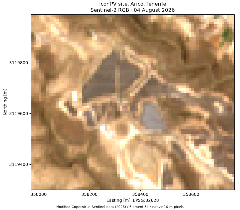
Use three public utilities to retrieve and inspect a real Tenerife PV site. ITER’s open location dataset locates Icor in Arico. Its 2019 programme (page 26) documents a 2 MW ground-mounted plant. Capacity is a source record, not a result inferred from these pixels.
The example pairs 4 August 2026 Sentinel-2 imagery with a later OSM snapshot. Plant boundaries and mapped panel groups remain separate features; their overlapping areas must not be summed. At 10 m, the image provides site context, while the OSM vectors can show finer detail than the pixels.
Contains modified Copernicus Sentinel data (2026), processed by Element 84; OSM data © OpenStreetMap contributors, ODbL-1.0.
Install the repository with its ground,examples extras. Bundled real
snapshots run offline; set ORBITALPV_GROUND_LIVE=1 to fetch a separate
copy. The downloaded script also fetches when its companion folder is absent.
See _data/README.txt for provenance and data-license details.
import os
from pathlib import Path
from pprint import pprint
from tempfile import gettempdir

import matplotlib.pyplot as plt

import orbitalpv as opv
example_dir = Path(__file__).resolve().parent if "__file__" in globals() else Path.cwd()
bundled = example_dir / "_data"
live = os.environ.get("ORBITALPV_GROUND_LIVE") == "1" or not bundled.is_dir()
site = opv.load_pv_site(
    name="Icor PV site, Arico, Tenerife",
    bbox=(-16.447, 28.192, -16.439, 28.198),
    time_min="2026-06-01",
    time_max="2026-09-01",
    max_cloud_cover=10,
    max_items=5,
    cache_dir=Path(gettempdir()) / "orbitalpv-ground-tenerife" if live else bundled,
    cache_prefix="tenerife",
    offline=not live,
)
pprint(site.summary(), sort_dicts=False)
{'name': 'Icor PV site, Arico, Tenerife',
 'bbox_wgs84': [-16.447, 28.192, -16.439, 28.198],
 'scene_id': 'S2A_T28RCS_20260804T115232_L2A',
 'acquired_at': '2026-08-04T11:53:59.065000Z',
 'scene_cloud_cover_percent': 0.155066,
 'search': {'returned': 5, 'matched': 9, 'limit': 5, 'limit_reached': True},
 'osm_timestamp': '2026-10-30T10:23:04Z',
 'osm_element_counts': {'way': 52},
 'images': {'visual': {'shape': [3, 69, 80],
                       'dtype': 'uint8',
                       'crs': 'EPSG:32628',
                       'pixel_size': [10.0, 10.0],
                       'bounds': [357970.0, 3119300.0, 358770.0, 3119990.0],
                       'masked_band_samples': 0},
            'red': {'shape': [1, 69, 80],
                    'dtype': 'uint16',
                    'crs': 'EPSG:32628',
                    'pixel_size': [10.0, 10.0],
                    'bounds': [357970.0, 3119300.0, 358770.0, 3119990.0],
                    'masked_band_samples': 0},
            'scl': {'shape': [1, 35, 41],
                    'dtype': 'uint8',
                    'crs': 'EPSG:32628',
                    'pixel_size': [20.0, 20.0],
                    'bounds': [357960.0, 3119300.0, 358780.0, 3120000.0],
                    'masked_band_samples': 0}},
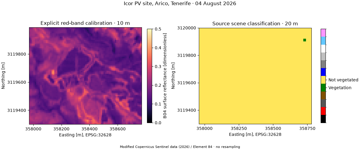
 'scl_pixel_counts': {4: 1, 5: 1434}}
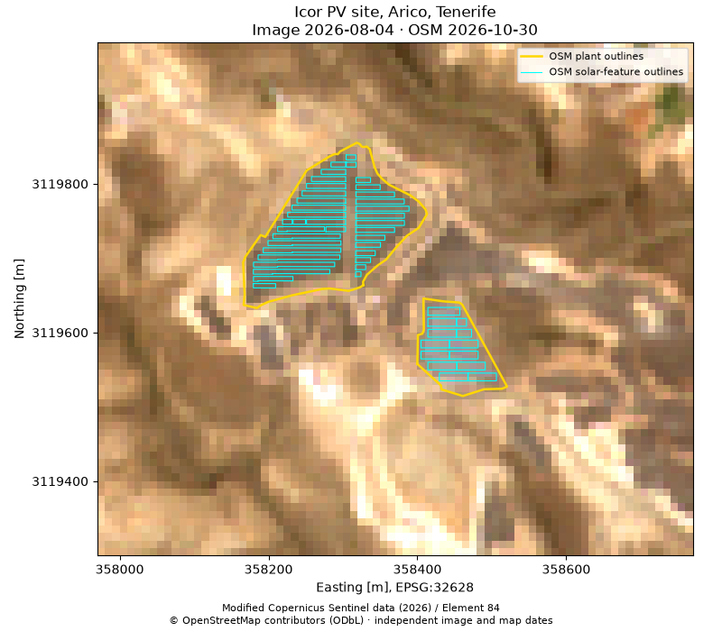
The helper uses source scale/offset metadata and keeps SCL on its own grid. Returned figures and axes remain available for further customization.
Total running time of the script: (0 minutes 0.584 seconds)