Note
Go to the end to download the full example code.
Geographic holdout on real Sentinel-2 imagery#
Train a supervised logistic baseline on Cestas and evaluate only in Tenerife. Compare the exact published ANDPI histogram rule as an explicitly standalone adaptation. The paper’s historical-inventory fusion is not reproduced here.
Sentinel-2 imagery is real, licensed cached data; OSM generator polygons are weak references. Outside buffered polygons is explicitly assumed negative. The prediction callable receives imagery features, never evaluation labels.
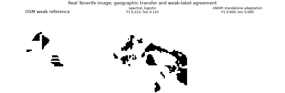
{'model': 'spectral_logistic', 'precision': 0.14109347442680775, 'recall': 0.5228758169934641, 'f1': 0.2222222222222222, 'iou': 0.125, 'relative_area_bias': 2.7058823529411766}
{'model': 'ANDPI standalone adaptation', 'precision': None, 'recall': 0.0, 'f1': 0.0, 'iou': 0.0, 'relative_area_bias': -1.0}
import json
from pathlib import Path

import matplotlib.pyplot as plt
import numpy as np

import orbitalpv as opv
from orbitalpv.ground_research import (
    SegmentationAdapter,
    adaptive_andpi,
    benchmark_segmentation,
    supervised_segmentation_adapter,
)

directory = Path(__file__).resolve().parent if "__file__" in globals() else Path.cwd()
data = directory.parent / "ground_imagery/_data"
configuration = json.loads((data / "pv-sites.json").read_text())
samples = {}
for name in ("cestas", "tenerife"):
    site = opv.load_pv_site(
        **configuration[name], cache_dir=data, offline=True, assets=("scl", *opv.PV_SPECTRAL_BANDS)
    )
    samples[name] = opv.prepare_pv_training_sample(site, site_id=name, background_is_negative=True)

models = [
    supervised_segmentation_adapter([samples["cestas"]], method="logistic"),
    SegmentationAdapter("ANDPI standalone adaptation", adaptive_andpi),
]
report = benchmark_segmentation(models, [samples["tenerife"]])
reference = samples["tenerife"]
fig, axes = plt.subplots(1, 3, figsize=(11, 3.6), constrained_layout=True)
axes[0].imshow(np.ma.masked_less(reference.labels, 0), cmap="Greys", vmin=0, vmax=1)
axes[0].set_title("OSM weak reference")
for ax, model, row in zip(axes[1:], models, report["results"], strict=True):
    ax.imshow(model.predict(reference.features).mask, cmap="Greys", vmin=0, vmax=1)
    ax.set_title(f"{model.name}\nF1 {row['f1']:.3f}; IoU {row['iou']:.3f}", fontsize=9)
    print(
        {
            key: row[key]
            for key in ("model", "precision", "recall", "f1", "iou", "relative_area_bias")
        }
    )
for ax in axes:
    ax.set_axis_off()
fig.suptitle("Real Tenerife image; geographic transfer and weak-label agreement")
fig.text(
    0.5,
    -0.03,
    "Copernicus Sentinel data · © OpenStreetMap contributors (ODbL)",
    ha="center",
    fontsize=8,
)
plt.show()
Total running time of the script: (0 minutes 0.484 seconds)